If you’re after rugged coastlines, dramatic cliffs, secret beaches, and charming villages, then the Anglesey Coastal Path must’ve crossed your radar.
This 130-mile loop (200km to be exact) hugs the edge of the island and offers some of the most rewarding coastal walking experiences in the UK.
Some people hit the trail for a full day of adventure, others prefer a slow wander with sea views and plenty of snack stops.
Whatever you like, the Anglesey Coast Path is welcoming to all. Let’s explore what makes this stretch of Welsh coastline so special.
What Is the Anglesey Coastal Path?
The Isle of Anglesey Coastal Path showcases the island’s diverse coastline. Winding through sandy bays, salt marshes, sea cliffs, and ancient woodlands, Anglesey’s coastal path showcases society’s old and new.
Officially starting and ending in Holyhead, the Anglesey Coast Path loops around the island’s perimeter.
- Total length: 130 miles / 200 km
- Time to walk the whole path: Around 10–12 days (with daily walks of 10–15 miles)
- Waymarked? Yes, with blue signs featuring a tern
- Accessible? Mostly yes, with clear paths and plenty of public transport links
- Need a map? Yes. An Anglesey Coastal Path map is a must, especially for the more remote sections of the walk
Experience The Anglesey Coastal Path- Whatever Your Fitness Level
You don’t have to tackle the full route in one go. Many walkers break it down into sections, depending on fitness levels and time.
Easy Options
- Beaumaris to Penmon Point: Flat, scenic, and sprinkled with history. Great for a morning out.
- Rhosneigr to Aberffraw: A breezy, beach-heavy walk with excellent views.
- Moelfre to Lligwy Bay: A short section with lots of heritage and seabird spotting.
Harder Sections
- Holyhead to Trearddur Bay: Rocky and undulating with stunning sea cliffs — a highlight, but expect a workout.
- Church Bay to Carmel Head: Remote, wild, and wind-battered — worth it for the views alone.
What’s the Best Section of the Anglesey Coastal Path?
This one’s a hot debate amongst walkers, but many rate the South Stack to Trearddur Bay stretch as the top traill. Described as dramatic, photogenic, and a haven of wildlife, this stretch of the path is the Insta-perfect picture of a lifetime.
Not to mention the views of the iconic South Stack Lighthouse, there’s no better place for a breather and a photo op.
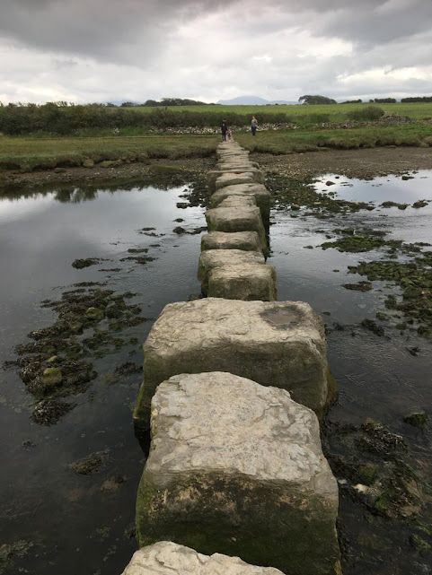
What Can You See Along the Way?
One of the best parts of the Anglesey coastal walks is the variety.
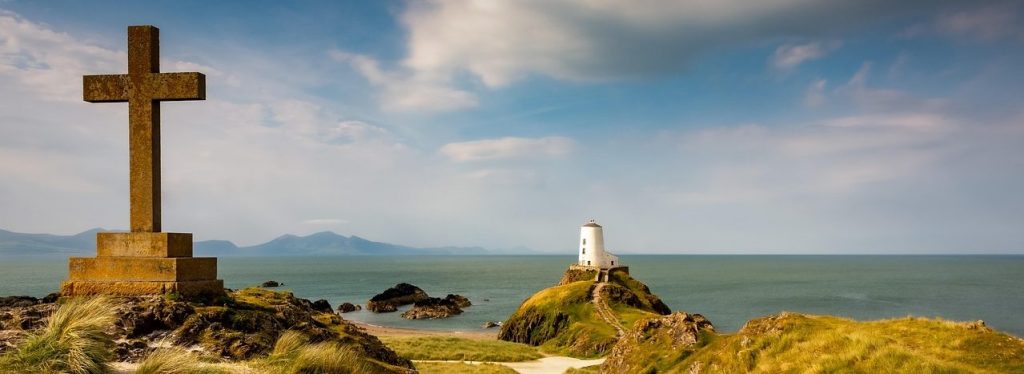
- Lighthouses: South Stack and Penmon Point are the big ones, though Anglesey is home to five in total
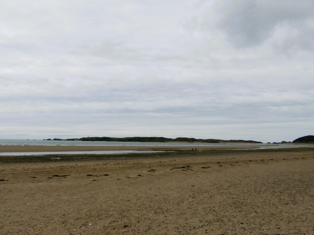
- Beaches: Newborough, Red Wharf Bay, and Lligwy are all stunners
- Wildlife: Keep an eye out for puffins, porpoises, seals, and even red squirrels in the woods
- Heritage: Prehistoric sites, castles, and old churches pop up along many routes
Where to Stay When Walking the Anglesey Coastal Path?
There’s no shortage of charming places to rest your head.
- Holyhead: Though the town is less scenic than other parts of the island, Holyhead is close to the start and end point with good amenities
- Beaumaris: A lovely town with great B&Bs and coastal charm
- Rhosneigr: Depending on the length of your stay, Rhosneigr is a popular area with surf vibes, beach cafés, and relaxed accommodation options
- Moelfre: A peaceful base with lots of walking options nearby
How Long Does It Take to Walk the Anglesey Coastal Path?
It depends entirely on you (and your group). Most people walk it in 10–12 days, doing about 10–15 miles per day, with a rest day or two thrown in.
You could stretch it out over a fortnight for a slower pace, or cherry-pick sections over weekend escapes. It’s handy to note that there are a few things that’ll affect your completion time, like adverse weather and steep inclines.
What Is the Most Scenic Part of Anglesey?
While it largely depends on what type of landscapes float your boat, a lot of people rave over:
- South Stack Cliffs with its epic heights and nesting seabirds
- Llanddwyn Island (near Newborough) for it’s history and charm

- Penmon Point because the views across to Puffin Island, and Snowdonia are unbeatable
Practical Tips
- Footwear: A good pair of walking boots is essential, even on the flatter parts of the route
- Weather: Be sure to pack for all seasons, it’s Wales after all!
- Maps & guides: Always carry a paper Anglesey coastal path map. GPS is handy but parts of the island are remote and signal can be touch and go
- Transport: Lots of bus routes connect the island if you’re doing a linear section
Fancy Giving It a Go?
The Anglesey Coastal Path isn’t just a walk, it’s a full island experience. Whether you’re in it for a weekend wander or the full 130-mile challenge, the combination of nature, history, and sea air is something special.
Challenge yourself, and don’t forget to send us some pictures!
FAQs
How long does it take to walk the Anglesey Coastal Path?
Around 10 to 14 days, depending on your pace and how much time you spend exploring along the way.
What is the best section of Anglesey Coastal Path?
Most people tend to prefer the Moelfre to Red Wharf Bay stretch for its dramatic cliffs, quiet coves, and sweeping sea views.
Where to stay when walking the Anglesey Coastal Path?
Stay in coastal villages like Rhosneigr, Moelfre, or Beaumaris. There are plenty of B&Bs, inns, and campsites that cater to walkers.
What is the most scenic part of Anglesey?
South Stack and Holyhead Mountain offer jaw-dropping views, wildlife, and dramatic cliffs. An absolute must-see for visitors.
Can you walk from Menai Bridge to Beaumaris?
Yes, it’s a 6-mile coastal walk with sea views and woodland paths, taking around 2–3 hours.
How long does it take to drive around the coast of Anglesey?
Without stops, roughly 2.5 to 3 hours. If you want to stop and explore, allow a full day.
What is the most beautiful part of the Wales coastal path?
Many say the Pembrokeshire Coast, but Anglesey’s mix of cliffs, beaches, and wildlife makes it a strong contender.
Can you do Anglesey in a day?
You can see highlights in a day, but to do it justice, a weekend or longer is much better.
Is there a coastal road around Anglesey?
Not a single road, but a network of scenic coastal routes, connects most seaside towns and villages.